Planning projects

This page discusses some of Reykjavík's largest planning projects. They will significantly influence the development of the city over the coming years.
Neighborhood plans
Neighborhood plans are land-use plans for established neighborhoods that aim to foster sustainable, environmentally friendly neighborhood growth in response to evolving societal priorities. The neighborhood plan will also make it easier for residents to apply for changes to their housing and lots.

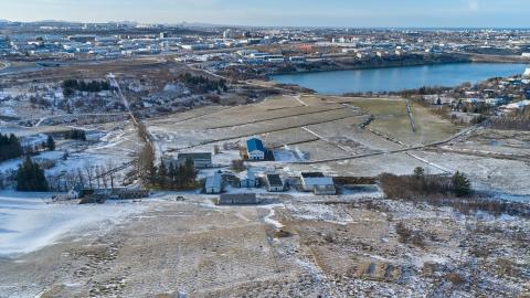
Keldur
Construction of a new and well-connected residential area in Reykjavík is pending. The goal is to build an exciting modern neighborhood, Keldur, based on eco-friendly transportation and fostering a carbon-neutral urban society.
The development is a collaboration between Reykjavík City and Transport for the Capital Area. The project is part of the Transportation Charter, and aims to accelerate the development of the future district at Keldur, as well as the construction of the CityLine. The estimated travel time by CityLine from Keldur to the city center is about 20 minutes.
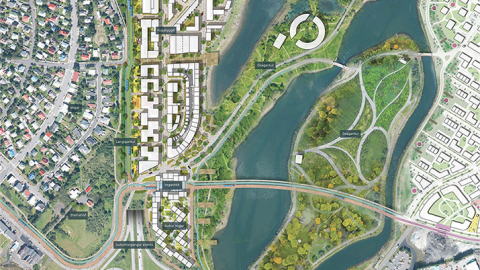
Elliðaárvogur, Ártúnshöfði
A new district in the making.
It is estimated that in this new district covering Ártúnshöfði and Elliðaárvogur, up to 8,000 dwellings will be constructed. In the planning stages currently on display, there is provision for 3,500 dwellings, two primary schools, and one consolidated school, along with commercial activity in the coming years. The backbone of the development runs alongside the planned CityLine, which passes through the center of the planning area.
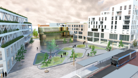
Miklabraut
Here you can check out the proposals of five interdisciplinary groups on how to implement the development on and around a road cap by Miklabraut. The proposals are the results of an idea search announced by Reykjavík City in 2020.
The proposals show the appearance and development possibilities of a significant new residential and commercial area on top of the cap and in its immediate vicinity, and how the development together with a CityLine center station connects to nearby neighborhoods and the surroundings.
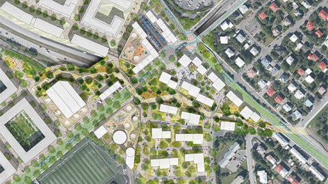
Sæbraut
Here you can check out the proposals of five interdisciplinary groups on how to implement the development on and around a road cap on Sæbraut by Vogahverfi. The proposals are the results of an idea search announced by Reykjavík City in 2020.
The proposals depict the layout and execution of the residential and service buildings along with connections due to the cap over Sæbraut by Vogahverfi, between Miklabraut/Vesturlandsvegur and north of Skeiðarvogur, along with the route of CityLine, both along Sæbraut and over Elliðavogur from Sævarhöfði to Suðurlandsbraut. The plan also provides for a CityLine central station in the area.