Háubakkar
Outdoor recreation areas
Súðarvogur/Naustavogur
104 Reykjavík
About Háubakkar
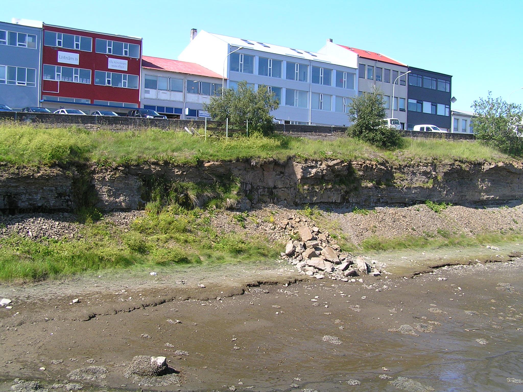
Háubakkar is one of six protected areas in Reykjavík. It features thick sedimentary layers showing evidence of Ice Age climate change impacts.
Háubakkar is a sedimentary sequence in Elliðaárvogur containing marine and terrestrial sediments with fossils, including lignite. Háubakkar were declared a natural monument in 1983. Natural monuments are a category of protected natural sites. They are unique natural phenomena, geological formations or organic features that stand out from their surroundings. These sites are preserved for their beauty, rarity, landscape value, scientific importance or other similar reasons.
Geology
The sedimentary layers in Háubakkar belong to the so-called Elliðavogur layers, which likely formed over a long period starting more than 300,000 years ago and lasting at least 100,000 years. Both marine and terrestrial sediments are present, indicating variable sea levels during formation. The Elliðavogur layers are thought to extend from Brimnes south to Álftanes, with Háubakkar being one of the better sites where the layers are exposed, as they are mostly buried under younger lava and sedimentary layers elsewhere. Below the sedimentary layers in Háubakkar is bedrock formed in the ancient volcano associated with Viðeyjarsund, which ceased activity more than 700,000 years ago after being active for nearly 2 million years. The oldest rock in Reykjavík formed in this volcano. The lowest sedimentary layers are glacial till likely over 300,000 years old. Above the glacial till are marine sedimentary layers indicating higher sea levels following glacier melting. The marine sediments contain several fossils, mainly bivalve species. These include Baltic tellin (Macoma calcarea), quahog (Arctica islandica), Greenland cockle (Serripes groenlandicus), and fine nut clam (Nucula tenuis). These species are somewhat cold-tolerant, suggesting sea temperatures were 1-2°C cooler than today. Above the marine sediment is more glacial till estimated to be about 250,000 years old. The top layers are terrestrial sediments, mainly peat sediments, including lignite about 200,000 years old. This indicates a lush wetland area and a slightly warmer climate than present. Various plant remains are found in the lignite. The Reykjavík gray basalt may have flowed during the same warm period when the lignite formed, as it lies on top of the Háubakkar sedimentary layers.
References
- Árni Hjartarson (1980): Late Quaternary stratigraphy in Reykjavík and vicinity, Náttúrufræðingurinn, 50:108-117.
- Bjarni Richter (1995): Stratigraphy and appearance of sedimentary layers in Reykjavík west of Elliðaár - Final thesis for B.Sc. degree in geology from the University of Iceland.
- Photograph: Snorri Sigurðsson.