05 Proposal for the Sæbraut Highway Cap
Proposal of Askur arkitektar, Efla, and Gagarín.
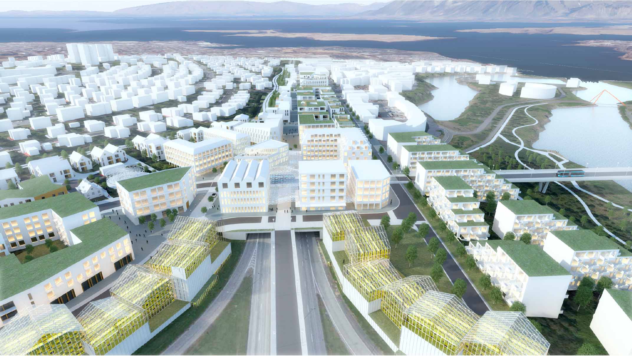
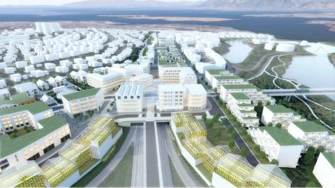
The Vogar neighborhood exists in our minds as an established area. The evolving Vogabyggð Development serves as an addition to the established Vogar neighborhood, and the new development at Sæbraut Highway Cap will ensure that Vogar becomes one of the more holistic and diverse neighborhoods of the city. Vogatorg Square will become one of the more significant interchange points for the CityLine and a destination in itself.
Explanation images
Details
Despite the urban development, the connections with Elliðaár and the valley are strong. Here is a place for cultural activities, dining venues, recreation, and outdoor activities.
- View the PDF document with the proposal.
The big picture
The Vogar neighborhood exists in our minds as an established area. The evolving Vogabyggð Development serves as an addition to the established Vogar neighborhood, and the new development at Sæbraut Highway Cap will ensure that Vogar becomes one of the more holistic and diverse neighborhoods of the city. Vogatorg Square will become one of the more significant interchange points for the CityLine and a destination in itself.
Despite the urban development, the connections with Elliðaár and the valley are strong. Here is a place for cultural activities, dining venues, recreation, and outdoor activities.
Video showing Sæbraut in a highway cap – Proposal of Askur arkitektar, Efla, and Gagarín.
Vogatorg Square performs a crucial role in transportation and services for eastern Reykjavík. Here, neighborhoods west and east of Sæbraut are connected by good green spaces for walking and cycling. Public transport routes also converge here, with north and south directions. A green belt with moderate development lies between Vogatorg Square and Skeiðarvogur. Monumental buildings near Dugguvogur gain a new role as one of the area's outer walls.
Highway cap implementation
The highway cap opens to the south before reaching Dugguvogur, and its opening is north of the junction between Skeiðarvogur and Kleppsmýrarvegur roads.
Suðurlandsbraut connects with Dugguvogur over the highway cap. The CityLine runs along Suðurlandsbraut, Vogatorg Square, and the new Elliðaár bridge east to Ártúnshöfði in a separate space.
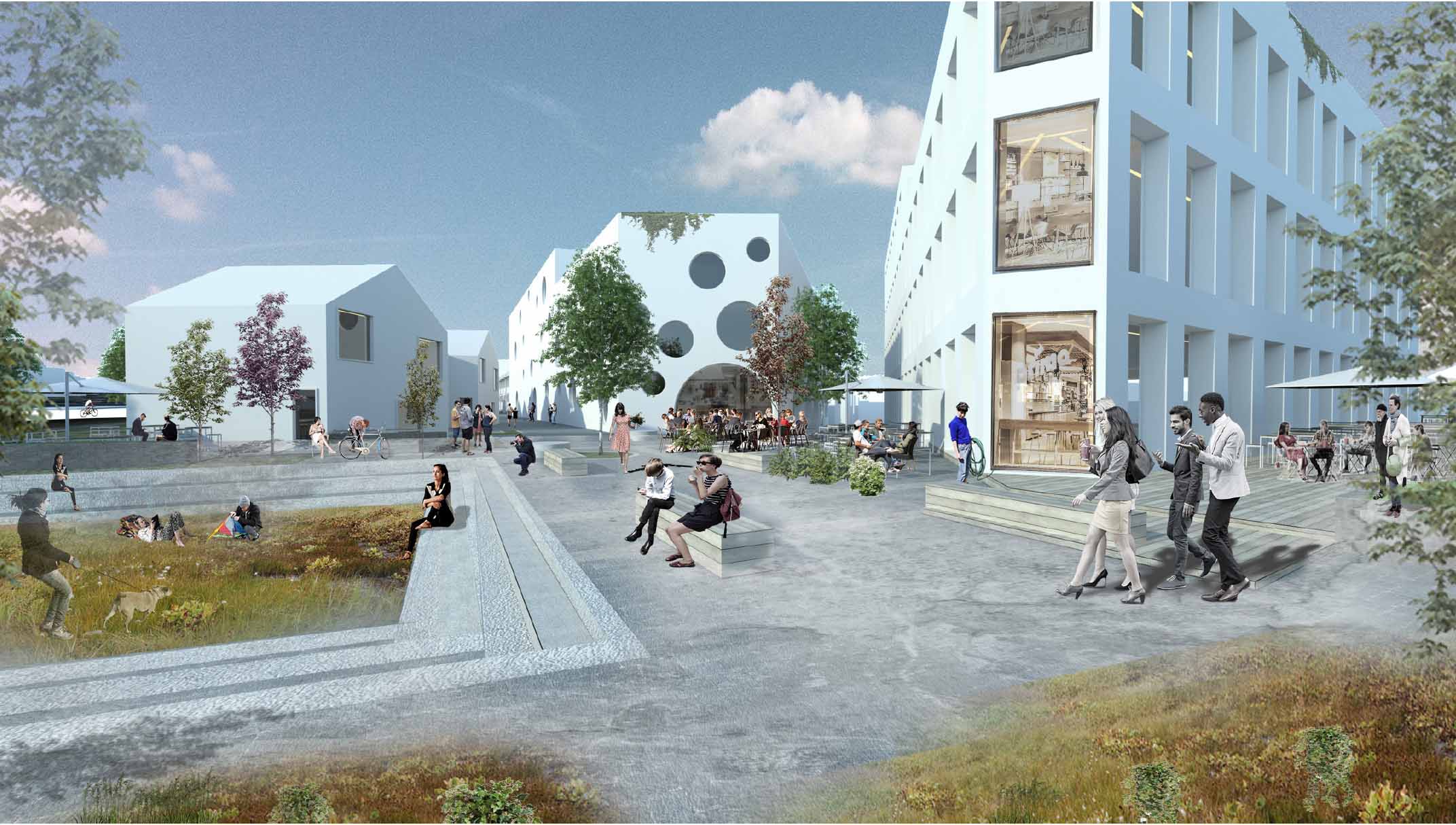
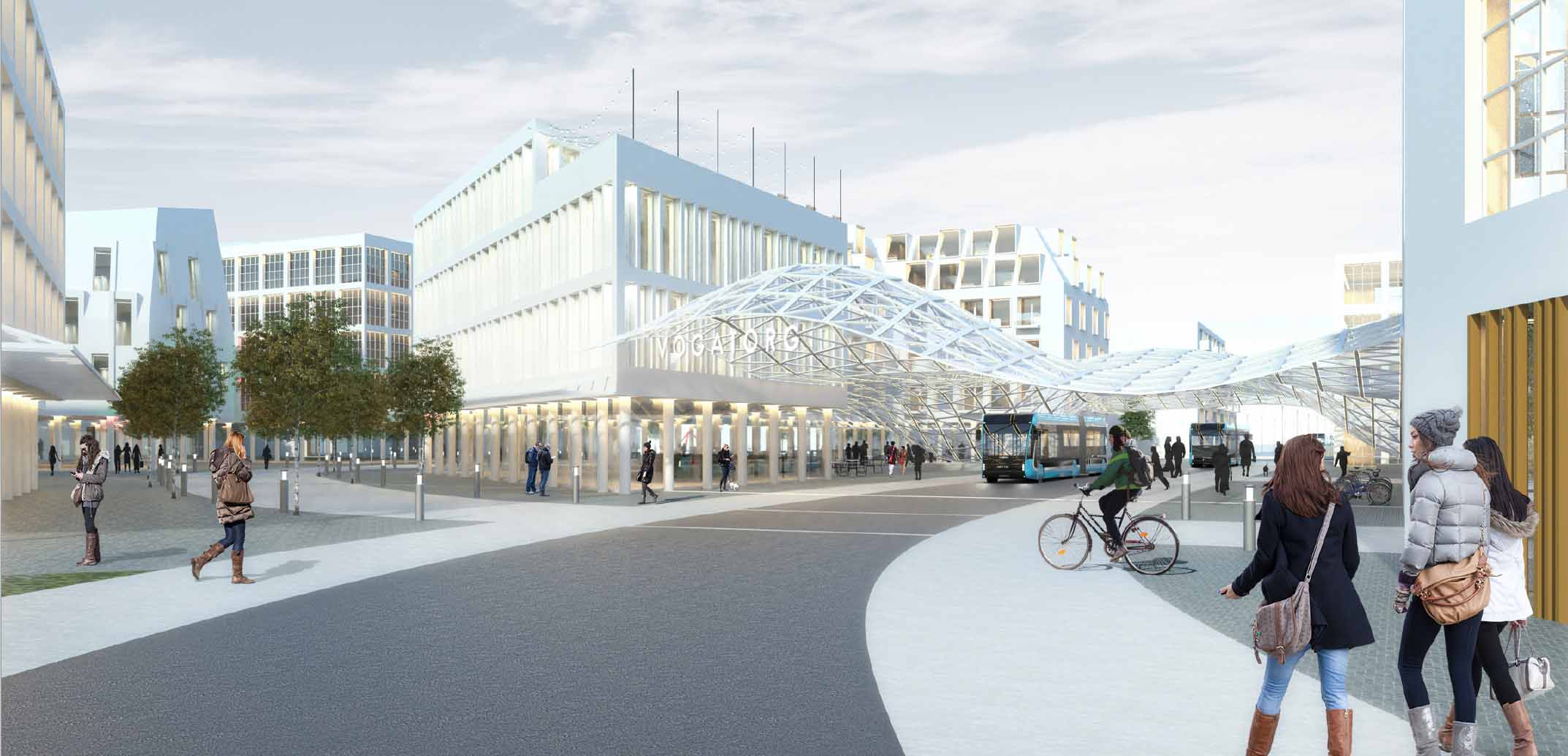
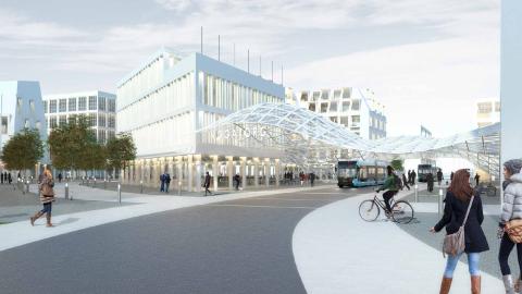
Vogatorg Square
Vogatorg Square is the heart of the reconstruction. Here, all public transport routes intersect, and the square constitutes a major stop for the CityLine between Ártúnshöfði and downtown Reykjavík. Residential buildings, commerce, and diverse activities provide a passenger base that will use the CityLine. Vogatorg Square is sheltered and partly roofed.
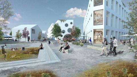
East and west of Vogatorg Square is a mixed residential area, on one hand around Steinahlíð and south of Suðurlandsbraut, and on the other hand towards Elliðaár rivers.
The connection between Mjódd and Vogatorg Square by public transport is over a bridge on a special lane between Sæbraut traffic lanes.
Listatröð
Between Vogatorg Square and Skeiðarvogur lies Listatröð. The east side of Listatröð already has magnificent buildings, and new buildings we propose, together with new buildings that form part of the land-use plan of Vogabyggð.
We expect smaller buildings to the west. There, we have dwellings and artist studios, shops, and some restaurants. The west side of Listatröð has a walking and biking path that connects with the city's pathway system to the north and south. It also interconnects with the pathway system near Suðurlandsbraut to Laugardalur.
Landmarks
We envision a blend of commercial activities and multi-tiered cultivation, or 'vertical farming,' toward the south of our development. This progressive approach to farming allows control over light conditions, humidity, heat, cooling, and air types, making indoor food and medicine production possible.
New concepts of environmental stewardship in agriculture lend themselves beautifully to this indoor cultivation technique. Vertical farming is, in many ways, similar to greenhouses where radiation and controlled lighting supplement natural sunlight. The primary goal of vertical farming is to maximize cultivation production in a limited space.
General traffic
Connective routes for general traffic have parallel parking and shared walking and biking paths. Between buildings within the neighborhood are paths serving emergency vehicles, waste collection, and residents' provisions. These routes are one way and marked as shared streets.
Pedestrian and bike path connections
A one-way pedestrian and bicycle path is on the new Elliðaár bridge. At Vogatorg Square, walking and biking paths converge and become two-way paths north of the CityLine.
The paths then connect with the city's transportation path that runs north-south along the Vogahverfi neighborhood and good transport paths along Suðurlandsbraut.
Pedestrian paths are along all streets, on both sides. There are varied pedestrian areas centered between gardens and squares where pedestrians are given preference.
- Light brown: Activities and services
- Dark brown: Homes
- Light blue: Commercial and service activities on the ground floor, and residences on the upper floors.