04 Proposal for the Sæbraut Highway Cap
Proposal from T.Ark, Verkís, Studio Egret West, and Integrated Transport Planning+
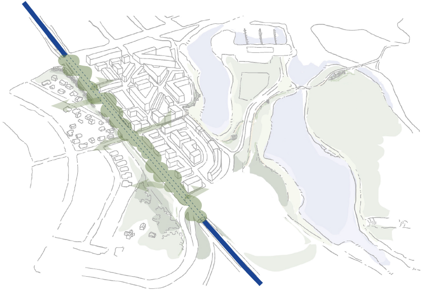
A long area forms on top of the cap over Sæbraut, between Vogar and Vogabyggð. The plan emphasizes it being used to form connections between the neighborhoods. This is, among other things, done through creating Langigarður, a park along the west side of the houses at Dugguvogur.
Explanation images
Details
The plan is for the park to serve the neighborhoods to either side, with a significant focus on a network of walking and biking paths connecting the neighborhoods, outdoor recreation areas, and nature.
The idea
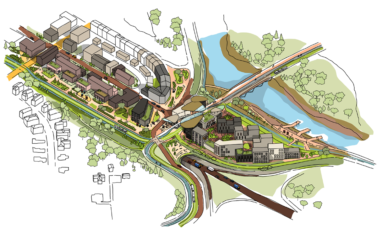
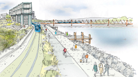
Sæbraut moves into a highway cap, removing a huge obstacle between the neighborhoods and opening a connection from Vogar to the coastline. The idea proposes most traffic disappearing from the surface, yet provides planning for the CityLine path along the highway cap.
A video shows Sæbraut in a highway cap – Proposal from T.Ark, Verkís, Studio Egret West, and Integrated Transport Planning+
Car traffic will only be at one spot above the southern end of the cap, where the route goes from Vogabyggð to Vogar parallel to CityLine and a walking and biking path.
Highway cap implementation
Moving Sæbraut into a cap removes the majority of car traffic from the surface. Pedestrian paths, biking paths, and public buses will be on the cap's top. Car traffic would be allowed only at one location where Suðurlandsbraut connects with Súðarvogur over the southern end of the cap.
Langigarður
A long area forms on top of the cap over Sæbraut, between Vogar and Vogabyggð. The plan emphasizes it being used to form connections between the neighborhoods. This is, among other things, done through creating Langigarður, a park along the west side of the houses at Dugguvogur. The plan is for the park to serve the neighborhoods to either side, with a significant focus on a network of walking and biking paths connecting the neighborhoods, outdoor recreation areas, and nature.
The plan is for an active park, which will serve the neighborhoods to both sides and attract people. Langigarður will focus on experience, entertainment, and services in a sheltered, comfortable environment. It will also provide diverse spaces for sports, games, and gatherings. Ball fields, skate areas, petang, tai chi, concerts, and other events.
Connections between the neighborhoods become possible through, among other places, Langigarður, which will be along the western side of residences near Dugguvogur.
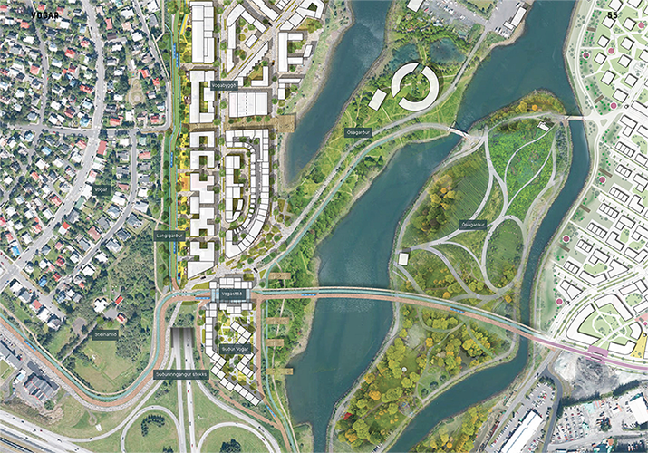
CityLine
The routes of the CityLine intersect at the southern end of Vogabyggð. The east-west route between Suðurlandsbraut and Ártúnshöfði runs in a bend along Steinahlíð over to the southern end of the cap to Vogastöð Station, and from there over a level bridge over the bay to Ártúnshöfði.
Vogastöð Station
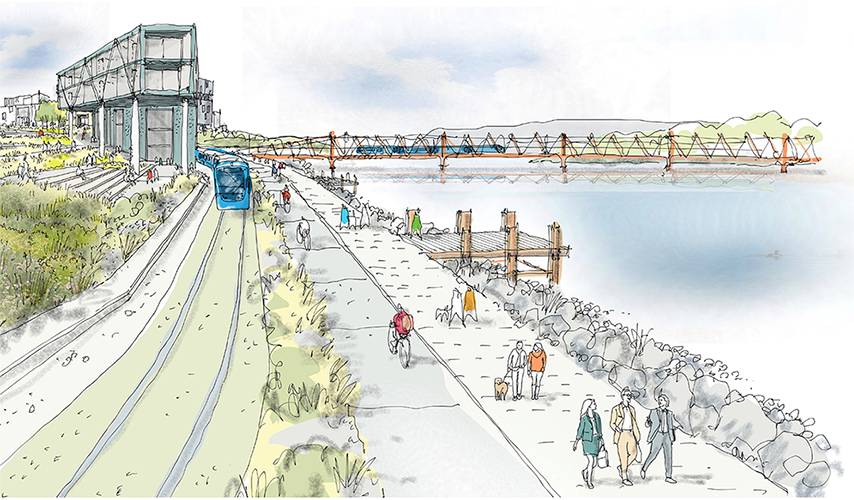
Many routes of the CityLine come together at Vogastöð Station located at the southern end of the cap, at the end of Langigarður and on the edge of the current and new residential area. The land east of the station slopes towards Elliðaárvogur, and it is expected that the CityLine will pass over a bridge over the bay to Ártúnshöfði. The station will become a significant destination for residents and tourists, and it will have shops and diverse services such as a café, library, greenhouse, and restaurant with a view over the bay.
South of the station, there will be a perimeter block three to four-story buildings around a sheltered courtyard. From the buildings at the bay, there is an unrestricted view over Ósagarður. The station is unique due to its proximity to the outdoor areas at the mouths of Elliðaár. The CityLine serves as a unifying thread, connecting neighborhoods around Elliðaárvogur, and Vogastöð provides a platform for community and play.
The location makes the station into a special place near natural areas, opening access to beautiful outdoor recreation areas beyond the stations located within the city.
New neighborhood
A residential area south of Vogastöð Station strengthens it as a neighborhood center. The neighborhood is bordered to the west and south by a curved perimeter block contrasting with the curved industrial buildings to the north that now characterize this area of Vogar. Within this built-up area, there's a communal garden and access space with buildings positioned at the edge by the CityLine that enjoy view over the sea and give shelter from the northern winds.