02 Proposal for the Sæbraut Highway Cap
Proposal from Yrki arkitektar, Dagný Land Design, and Hnit verkfræðistofa.
New buildings on the Sæbraut Highway Cap will connect the mature Vogahverfi neighborhood with the new Vogabyggð neighborhood. The cap also provides a new and stronger connection from Vogahverfi to Elliðaár and Elliðaárdalur. This creates a continuous area of buildings from Laugardalur to Elliðaárdalur.
Explanation images
Details
New buildings on the cap are extensions from the plots east of Sæbraut. In this way, the new buildings bridge Vogabyggð with Vogahverfi.
New construction on top of the cap
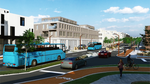
New buildings on the Sæbraut Highway Cap will connect the mature Vogahverfi neighborhood with the new Vogabyggð neighborhood. The cap also provides a new and stronger connection from Vogahverfi to Elliðaár and Elliðaárdalur. This creates a continuous area of buildings from Laugardalur to Elliðaárdalur.
New buildings on the cap are extensions from the plots east of Sæbraut. In this way, the new buildings bridge Vogabyggð with Vogahverfi.
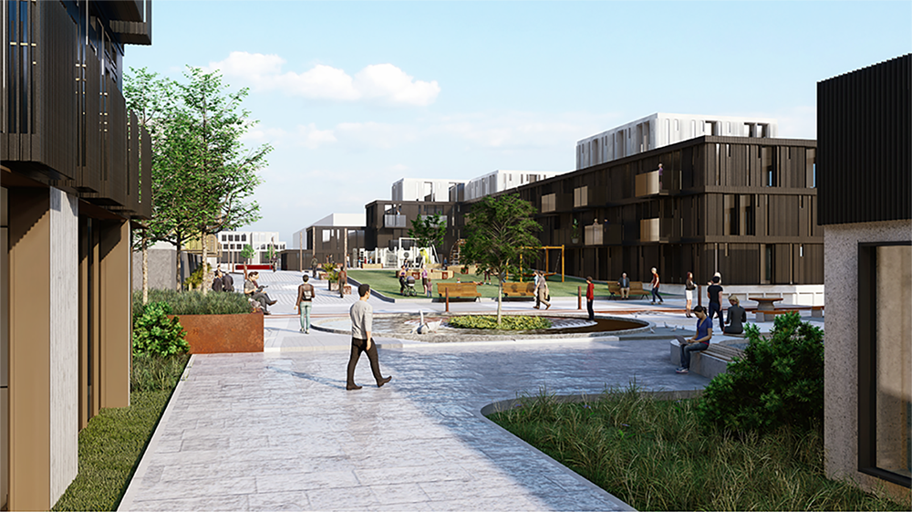
The location and layout of the buildings are designed to create interesting and sheltered public spaces between the buildings. The inhabited area is then shaped and broken up to ensure areas between the buildings get a lot of sunlight. The heights and volume of the buildings also take into account the adjacent buildings so that new buildings blend well with the existing ones. The buildings then shape an interesting interplay of courtyards, playgrounds, and squares that are connected by paths and streets.
A video showing Sæbraut in a highway cap – Proposal from Yrki arkitektar, Dagný Land Design, and Hnit verkfræðistofa.
Highway cap implementation
The cap extends from the intersection of Skeiðarvogur and Sæbraut to the split-level interchange by Vesturlandsvegur. This eliminates two traffic light-controlled intersections on Sæbraut, at Skeiðarvogur and Súðarvogur.
New neighborhood center
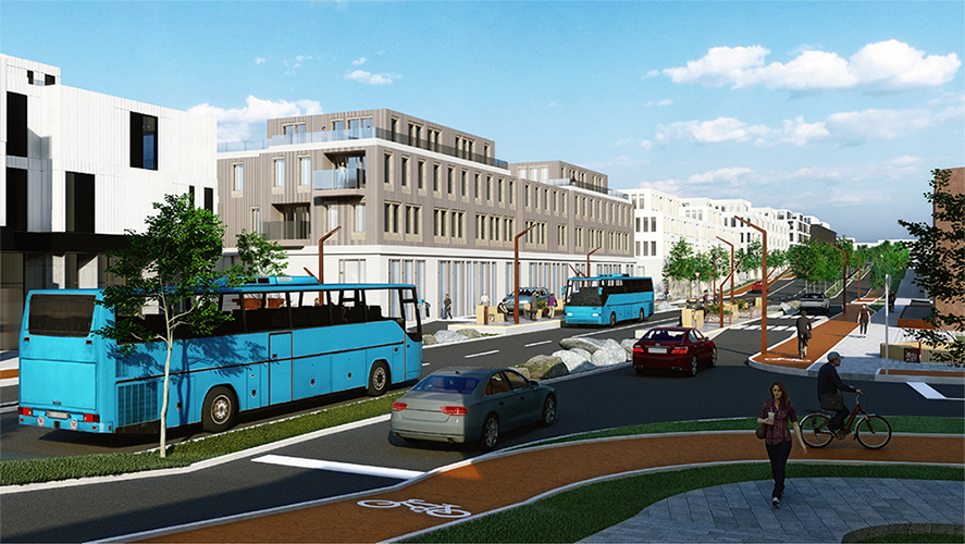
The introduction of CityLine into the neighborhood, creates an even stronger connection for residents to other parts of the city and the capital area.
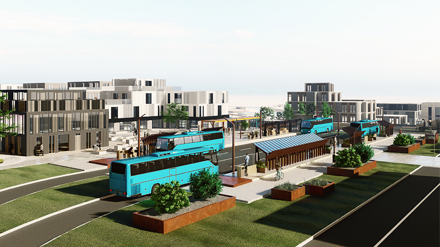
The CityLine's central stations are transport hubs where heavy pedestrian traffic can be expected. The stations are important connection points in the Strætó and CityLine route network. This creates new opportunities for commerce and services that rely on heavy foot traffic. This encourages the operation of commerce and services in and around the central stations.
The plan is to locate the majority of shops and services in and around the central station, thereby creating a new neighborhood center.

The central station
The CityLine central station is located on top of the cap at the end of Súðarvogur and Dugguvogur. Suðurlandsbraut is extended and meets Dugguvogur at the central station.
The area around the central station is the focus for businesses, services, and offices.
The central station at the end of Dugguvogur creates conditions for further development of commerce and services along the street, and businesses are directed there. This makes Dugguvogur the service and shopping street of the neighborhood.
The location of the station, between Vogahverfi and Vogabyggð, makes it accessible to both neighborhoods.
Vogatorg Square
The central station and buildings around it form a new square, Vogatorg Square, which opens to the south.
Dugguvogur in shared space for pedestrians and cyclists.
As stated before, the proposal is primarily on the terms of pedestrians. Pedestrians move slower and thus have more opportunities to experience and perceive their surroundings better.
Special attention is paid to having a dense network of walking paths along streets and paths between public areas so that the area offers both efficient walking paths to move along, as well as a good and diverse experience for people who want take a longer route home.
Contact us
Email: skipulag@reykjavik.is
The project is under the jurisdiction of the Planning Officer at the Department of Environment & Planning of Reykjavík City.