05 Proposal for the Miklabraut Cap
Proposal of Askur arkitektar, Efla, and Gagarín.
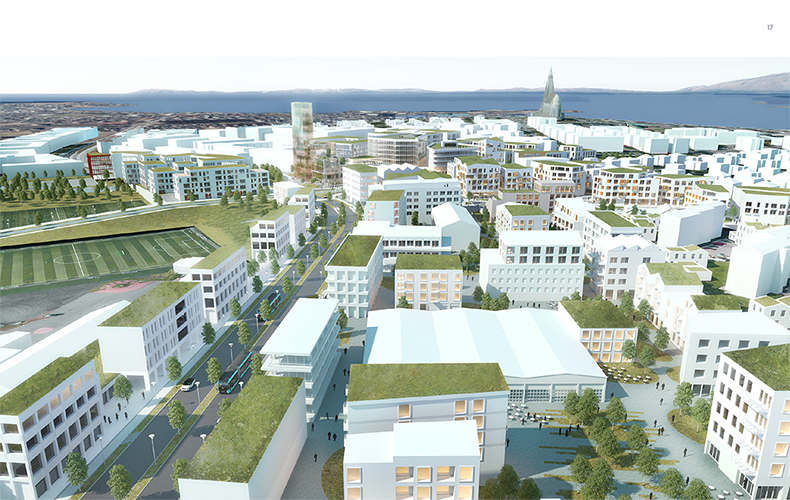
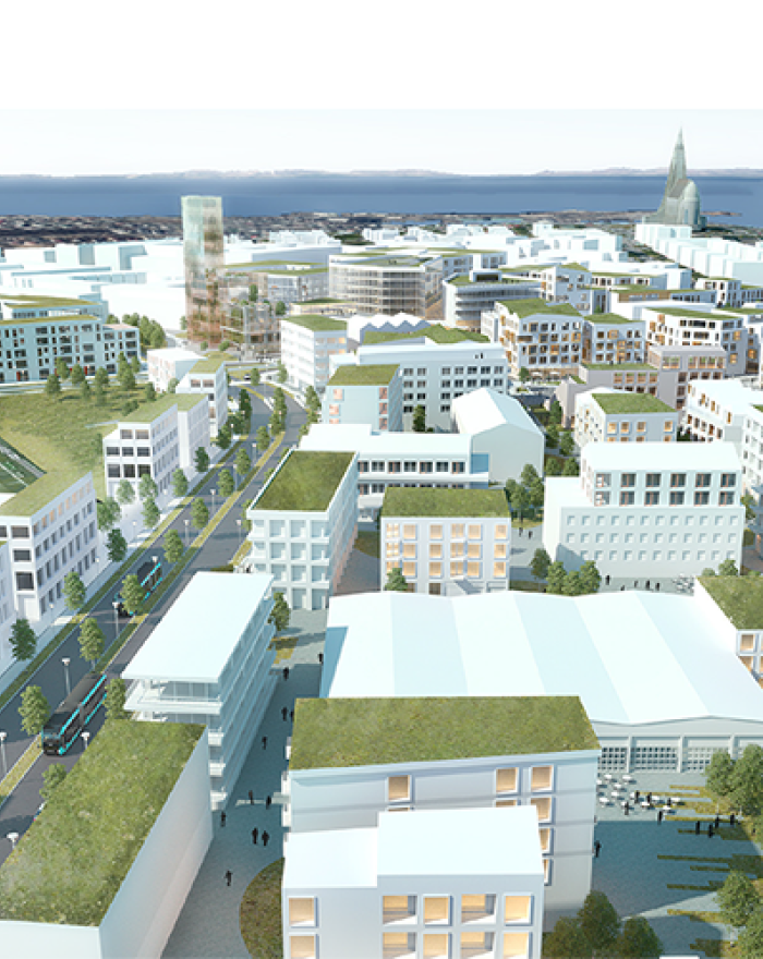
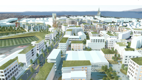
Miklatorg is at the heart of the idea, located east of Snorrabraut. It stretches towards Landspítali, "Brooklyn", Klambratún, and Hlíðarendi. This is a confluence of daily life in the city. It is bustling with people coming and going with different intentions.
Explanation images


What are your thoughts?
The hospital is one of the main players, both universities, connection to the airport, sports activities in Hlíðarendi and the outdoor recreation areas in Öskjuhlíð and Klambratún. This area also links the neighborhoods that surround it.
The big picture
The intersection of Miklabraut, Snorrabraut, and Bústaðavegur are busy and complex today. The intersections are mainly on the terms of the driver, and other transport methods are facing an uphill structure. This changes with moving the main east/west car traffic set in to a highway cap opening the area on new terms for all modes of transport. Snorrabraut stays where it is, connecting to Hlíðarendi through the CityLine. Miklabraut stays where it is, connecting to Snorrabraut, but because the main east/west traffic is not disruptive, we can have more human-friendly intersections. Bústaðavegur stays where it is, but connects to Snorrabraut in a simple and easy-to-understand way.
These changes have an impact far beyond these main connections. There are new opportunities eastward to develop built areas that has been in some kind of standstill due to traffic and traffic structures. Yet other possibilities open to the west, where we propose that the main public bus station connects to the area and at the same time the country's largest employer, Landspítali Hospital. Let's not forget the connection to the south at Hlíðarendi, the University of Reykjavík, and the airport area. Here, enormous opportunities open up for the development of areas in strong connections with the city center.
A video showing Miklabraut in a highway cap – Proposal from Ask arkitektar, Efla, and Gagarín.
These modifications of road intersections open enormous opportunities to shape the landscape and development of this area. The terrain is shaped based on a completely new premise from before. The connections between Norðurmýri and Hlíðarendi and Öskjuhlíð and Landspítali are almost car-free, lush areas.
We have divided our suggestions into four main areas:
- Miklatorg Square
- CityLine station
- The area between Skógarhlíð and Bústaðavegur, an area we affectionately call the Brooklyn of the North.
- Housing in the northern part of Hlíðarendi and along Bústaðavegur
Highway cap implementation – traffic
Main east/west vehicle traffic through Miklabraut/Hringbraut is put into a highway cap. Traffic traveling west to east around Hringbraut, and heading out to the countryside, goes into these caps. This also applies to traffic from the east that should not be near Miklatorg. In our proposal, Bústaðavegur acts as a sort of boulevard from Flugvallarvegur to Snorrabraut. Our vision of the future is for Bústaðavegur on the east side of Arnarhlíð to be a lush boulevard, complete with one-way cycling and walking paths on both sides and parallel parking spaces. Bústaðavegur will connect with Hringbraut via traffic light-controlled intersections at Snorrabraut.
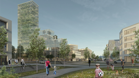
Landmarks
South of Snorratorg, which lies along Snorrabraut atop the highway cap, are two buildings. One is the House of Mediation, Innovation, Design, and next to this, the main landmark of the area: Gróðurhöllin, a vertical farming facility rising many levels high.
This progressive approach to farming allows control over light conditions, humidity, heat, cooling, and air types, making indoor food and medicine production possible.
The building houses versatile activities, with cultivation as the main theme, and will become a landmark for the area and our future in climate change issues.
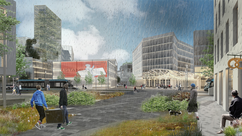
CityLine
On Burknagata, west of Snorrabraut and on Snorrabraut itself, are the main bus stops. By dividing these, we can reduce their size and distribute the load. On this section of Snorrabraut, all modes of transportation are considered equal (shared space). At the corner of Burknagata and Snorrabraut, there are two buildings hosting varied services, the new BSÍ, or transportation hub. The buildings are connected with a covered pedestrian street.
Here, shops and restaurants are located, and there is an opportunity to grab the last cup of coffee before heading out. The corner store is also here with essential ingredients, and the flower shop that sells us the bloom of the day when we visit grandma in the hospital.
Brooklyn of the North
With fresh thinking, development opportunities open up in the area between Bústaðavegur and Skógarhlíð. Currently, the area is minimally utilized with detached buildings and massive parking spaces. We envision a reconstruction that densifies the cityscape and creates an environment of new buildings in harmony with the older ones.
Shared streets and parking garages
Connective routes for general traffic have parallel parking and shared walking and biking paths. Between buildings within the neighborhood are paths serving emergency vehicles, waste collection, and residents' provisions. These routes are one way and marked as shared streets.
Walking and biking paths
To better connect the current cityscape and Valur sports area with the development at Miklatorg, a pedestrian path is planned through Miklatorg and Brooklyn (the area between Bústaðavegur and Skógarhlíð) and bright underpasses under Bústaðavegur at Arnarhlíð.
Pedestrian paths run alongside all main traffic routes, on both sides. Pedestrian areas are between gardens and squares throughout the area so pedestrians have priority, in line with the emphasis of Reykjavík’s city planning over the last few years.
Contact us
Email: skipulag@reykjavik.is
The project falls under the jurisdiction of the Office of the Planning Officer at the Department of Environment & Planning of Reykjavík City.