Fossvogsbakkar
Outdoor recreation areas
Fossvogur
105 Reykjavík
About Fossvogsbakkar
Fossvogsbakkar is one of six protected areas in Reykjavík. It features thick marine sedimentary layers from the end of the Ice Age.
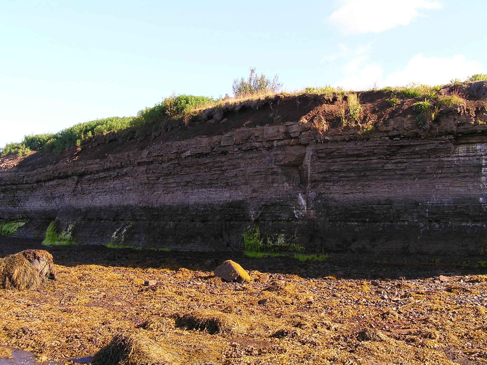
Fossvogsbakkar is at the inner end of Fossvogur and follows the coastline about 2 km westward to Nauthólsvík. Fossvogsbakkar contains geological heritage, with marine sedimentary layers from the end of the Ice Age 11,000 years ago. The sedimentary layers contain various fossils, mainly mollusk shells. Glacial sediment in the layers provides information about the history of glacier retreat in the area. Fossvogsbakkar were declared a natural monument in 1999. Natural monuments are a category of protected natural sites. They are unique natural phenomena, geological formations or organic features that stand out from their surroundings. These sites are preserved for their beauty, rarity, landscape value, scientific importance or other similar reasons.
Geology
The sediments in Fossvogsbakkar are thought to be about 11,000 years old, from the end of the last Ice Age. They likely formed during one of the last warm periods after glacier melting led to significant sea level rise. The layers span a 2 km coastline but vary in thickness and are partly eroded by sea forces in some places. The layers are thickest at the bottom of Fossvogur and the westernmost part of the sedimentary sequence, near Nauthólsvík. The maximum thickness of the sedimentary layers is just under 5 meters.
The sedimentary layers lie on top of gray basalt bedrock belonging to the Reykjavík gray basalt, which formed during volcanic eruptions in warm periods of the last Ice Age, probably 100-200 thousand years ago. The lowest layer of the sediments is glacial till formed from glacial drift, indicating glacier retreat. Glacial striations are visible on some boulders in the glacial till layer. The next layers are marine sediments, mainly fine-grained silt and mudstone layers, but also cross-bedded sandstone in some places. This suggests that sea levels rose and the area became shallow sea.
The siltstone layer shows evidence of ripples and sand waves, which are signs of tidal currents. The marine sediment contains many fossils. The sediments primarily contain bivalve shells. These include Baltic tellin (Macoma calcarea), Arctic saxicave (Saxicava arctica), truncate softshell clam (Mya truncata), boreal astarte (Astarte borealis), arctic yoldia (Leda pernula), and quahog (Cyprina islandica). Other species are also present, including gastropod shells like common whelk, and barnacle shells. Most fossils are found unbroken in life position, indicating the sediment formed under calm conditions.
Above the marine sediment is more glacial till, suggesting that the very last glacial periods of the Ice Age occurred after the sedimentary layers formed. This glacial till shows prominent evidence of flowing water effects, indicating the glacier was thin and mobile, as the Ice Age was finally ending.
References
- Notice of declaration of protection for Fossvogsbakki in Reykjavík (1999). Official Gazette, Section B, No. 236.
- Árni Hjartarson (1980): Late Quaternary stratigraphy in the Greater Reykjavík Area, Náttúrufræðingurinn, 50:108-117
- Áslaug Geirsdóttir (1979): Fossvogur layers - Final thesis for B.Sc. degree in geology from the University of Iceland
- Photograph: Snorri Sigurðsson.