Laugarás
Outdoor recreation areas
Laugarás
104 Reykjavík
About Laugarás
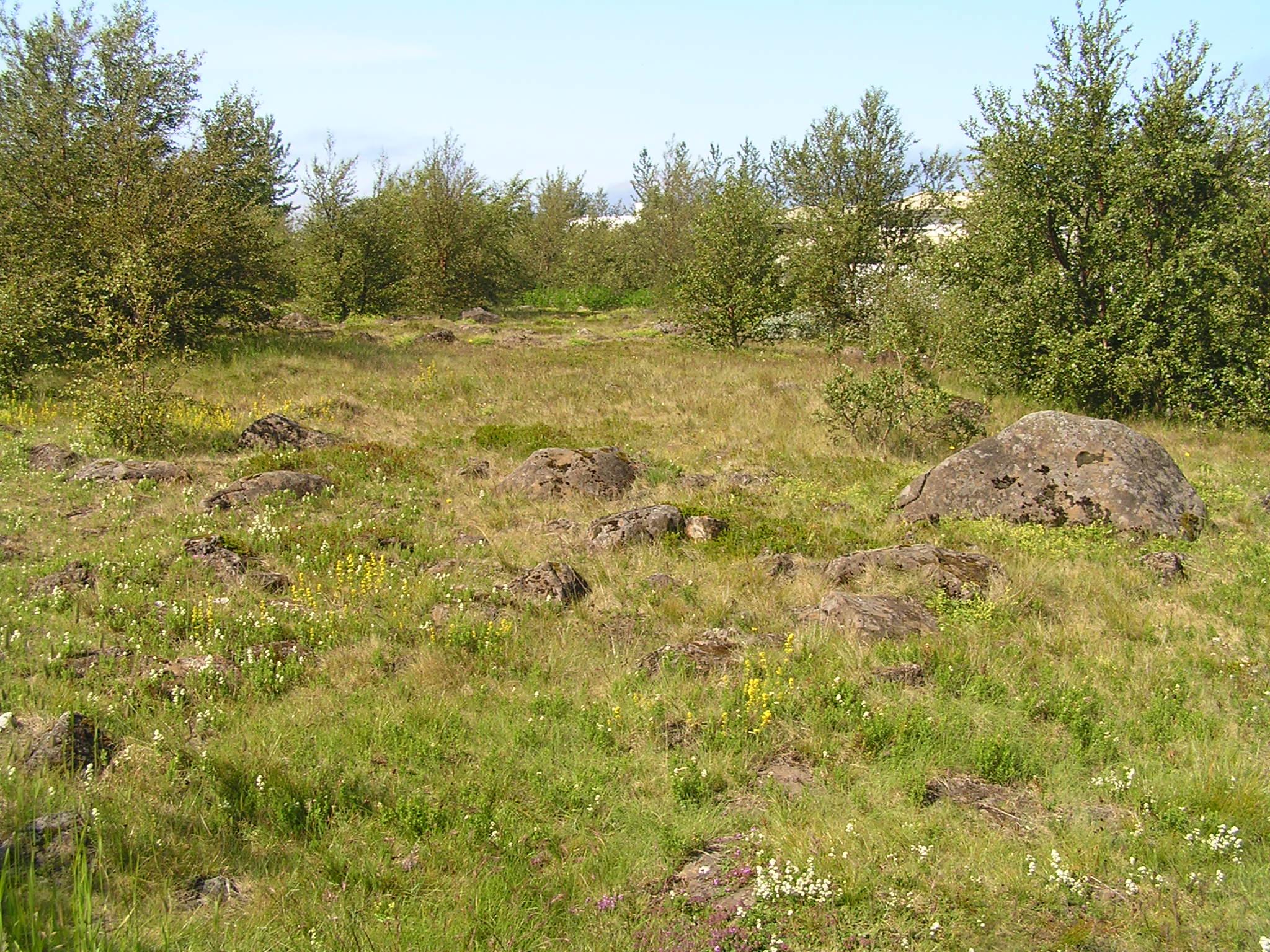
Laugarás is one of six protected areas in Reykjavík. It features geological heritage from the Ice Age, glacially striated rock and evidence of higher sea levels.
Laugarás in the Langholts neighborhood was designated a natural monument in 1982. Natural monuments are a category of protected natural sites. They are unique natural phenomena, geological formations or organic features that stand out from their surroundings. These sites are preserved for their beauty, rarity, landscape value, scientific importance or other similar reasons.
Laugarás is a valuable outdoor recreation area. The area is elevated with good views in all directions, overlooking the city, straits, and mountains. It sits amid residential areas near other important outdoor and nature areas, Laugardalur and Laugarnes. However, it stands out due to its landscape position, rocky terrain and distinctive heath vegetation in parts of the area.
Geology
The geological heritage features are concentrated at the highest point. These include large gray basalt rocks, rounded bedrock and boulders belonging to the large Reykjavík gray basalt formation. The gray basalt in Laugarás likely dates back about 200,000 years, when the Reykjavík gray basalt buildup was at its peak. Ice Age glaciers shaped the gray basalt in Laugarás, as in many other parts of Reykjavík, with visible glacial striations on larger boulders. At the end of the Ice Age, sea levels rose significantly as glaciers melted. Laugarás was one of few places in present-day Reykjavík not fully submerged when sea levels peaked about 45 meters higher than today. Only the very top of Laugarás emerged, making it little more than a reef. Evidence of this can be seen on large rocks near the highest point, which are wave-worn. The markings are similar to those in Öskjuhlíð, though on a smaller scale.
References
- Notice of declaration of protection for Laugarás in Reykjavík (1982). Official Gazette, Section B, No. 41.
- Árni Hjartarson (1980): Late Quaternary stratigraphy in Reykjavík and vicinity, Náttúrufræðingurinn, 50:108-117
- Photograph: Snorri Sigurðsson.