CityLine land-use plan for Suðurlandsbraut open for public comment
The proposed CityLine land-use plan for Suðurlandsbraut is now open for public comment. The planning area covers the redesigned streetscape of Suðurlandsbraut between Skeiðarvogur and Lágmúli.
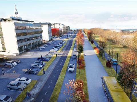
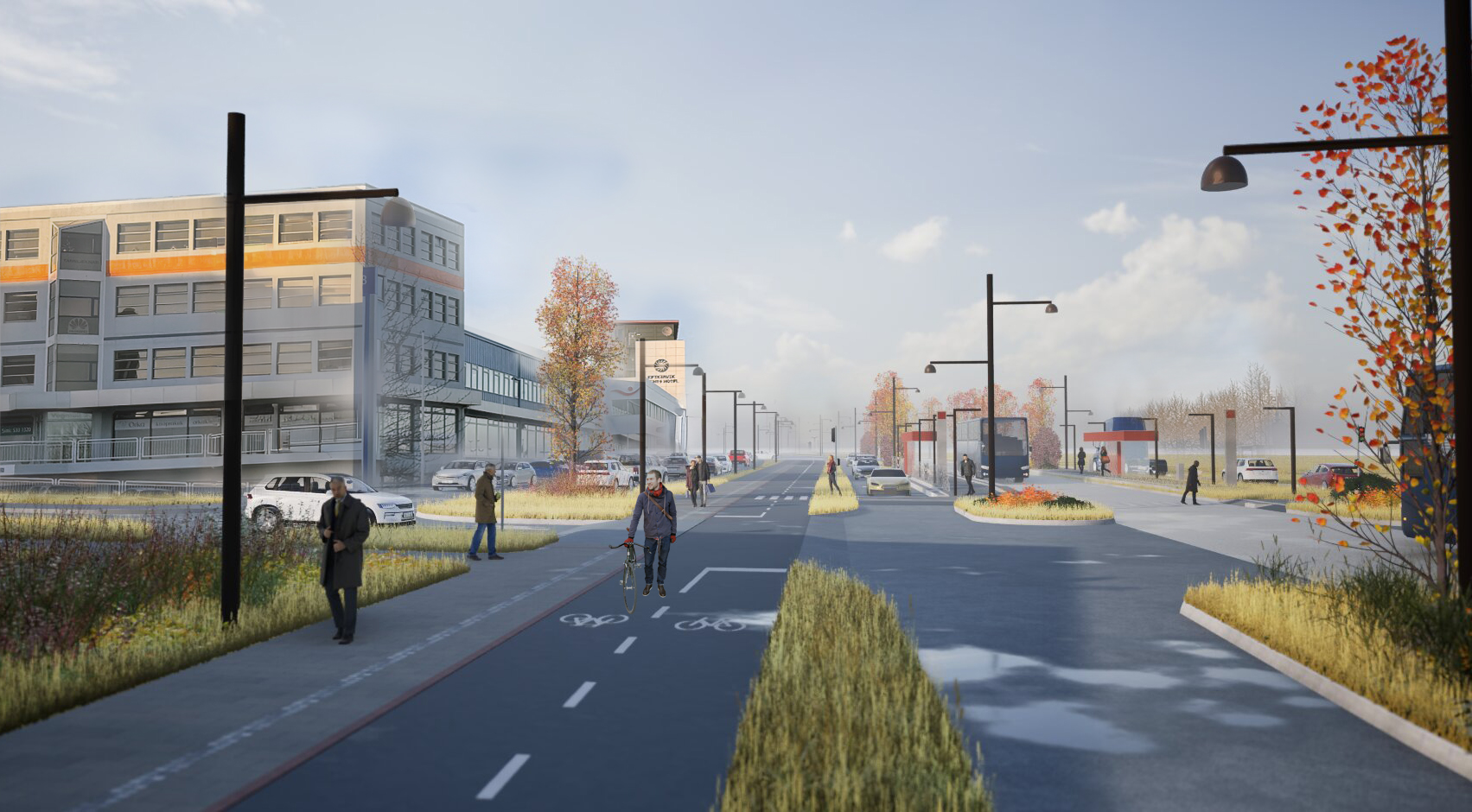
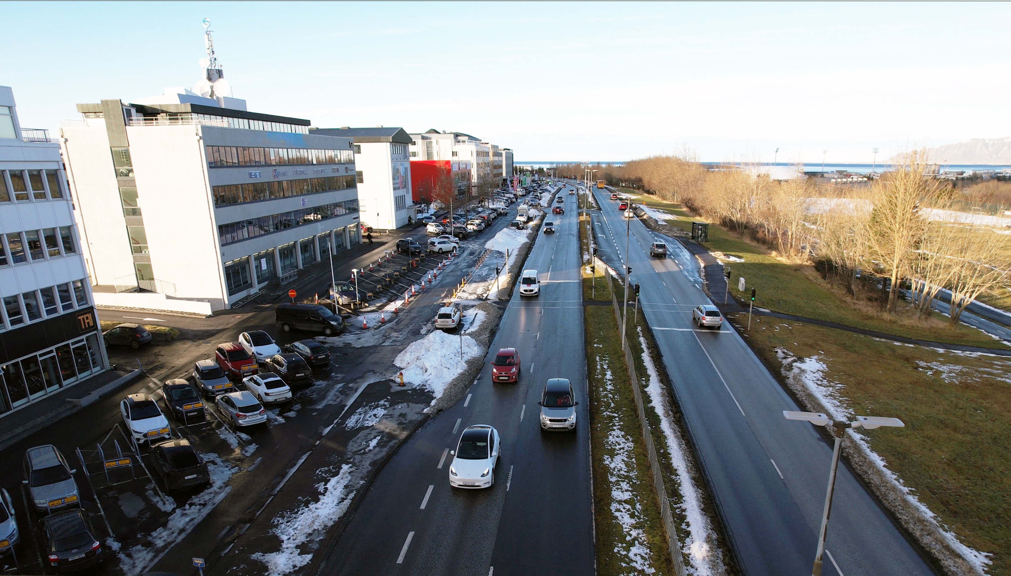
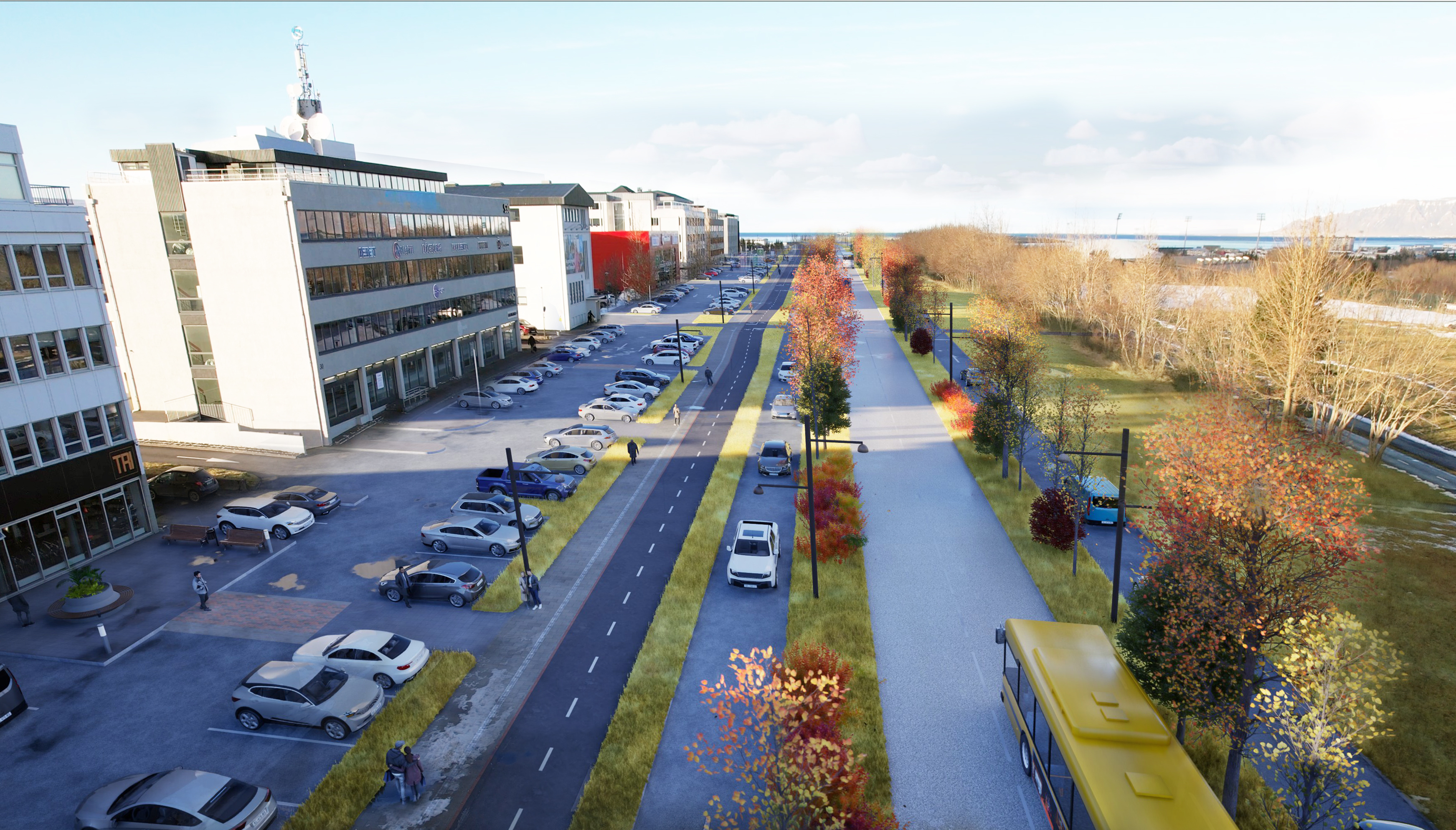
Images - before and after

Securing this land-use plan is a crucial step before construction can begin. Development plans define how the environment will be shaped, where stations will be located and how people will move through the areas. Nine land-use plans incorporating CityLine have already been approved. These cover: Previously approved sections include Fossvogsbrú, Nauthólsvík, Reykjavík University, Nauthólsvegur, the new Landspítali Hospital, Hlemmur, the upper section of Laugavegur, and two parts of Ártúnshöfði. The first phase of CityLine, which runs between Ártúnshöfði and Hamraborg via Fossvogur Bridge, covers 12 kilometers in Reykjavík.
Main changes to Suðurlandsbraut
These are the main changes planned for Suðurlandsbraut:
- New CityLine tracks will be constructed between Skeiðarvogur and Lágmúli, along with three stations: at Glæsibær, Laugardalshöll Arena, and Lágmúli.
- New biking and walking paths will be added south of the CityLine tracks, while existing paths on the north side will remain unchanged. This will significantly improve access for active transportation along the street.
- Lanes for general vehicle traffic will mostly be reduced to a single lane in each direction, except at major intersections where additional turning lanes may be provided.
- The street’s green character will be enhanced with designated areas for vegetation and above-ground stormwater solutions.
- Vehicle access and parking at Suðurlandsbraut 4-32 will be reconfigured.
Standard stations will have 20-meter-long platforms. However, the station at Laugardalshöll Arena and the future national concert hall will feature longer, 40-meter platforms to handle increased capacity for major events in Laugardalur. All stations will include bike parking.
A video explaining the proposed changes to the land-use plan is available here.
Changes to intersections
The revised land-use plan involves redesigning intersections on Suðurlandsbraut to improve traffic safety, increase CityLine efficiency, and enhance conditions for pedestrians and cyclists.
This will place some limits on left-turn options at intersections. However, this does not apply to the largest intersections, which will continue to have traffic lights and allow all turns. These are the intersections at Reykjavegur, Vegmúli, and Grensásvegur.
At several other intersections, left turns will be restricted. At Álfheimar, traffic lights will remain, but left turns from Suðurlandsbraut will not be permitted. Left turns from Álfheimar will still be allowed. Elsewhere, drivers will only be able to exit or enter Suðurlandsbraut with a right turn. To increase safety and visibility, walking and biking paths parallel to Suðurlandsbraut will be raised over cross streets. The intersection of Suðurlandsbraut and Engjateigur will be closed.
Dedicated lanes for CityLine
The plan establishes two dedicated center lanes for CityLine throughout the entire planning area. Center-aligned lanes are considered optimal for traffic safety and accessibility. The layout is designed to provide the most direct and safest possible pedestrian and cyclist access to CityLine stations from services and workplaces south of Suðurlandsbraut. This design also reduces negative impacts at intersections and property access points, as vehicles will not need to yield to CityLine buses. When measured by the number of individuals rather than vehicles, the dedicated CityLine lanes will increase Suðurlandsbraut's transportation capacity beyond what is possible under the current arrangement.
Changes to parking
As part of the Suðurlandsbraut redesign, changes to parking are planned for Suðurlandsbraut 4–32. These lots are adjacent to the planning area but fall outside the boundaries of the plan currently under review.
Parking in this area is located both on private property and on municipal land. To make room for CityLine and improve facilities for pedestrians and cyclists, existing parking on municipal land will be eliminated.
A parking analysis of this area shows there are currently about 1,600 parking spaces on lots and municipal land at Suðurlandsbraut 4–32. Of these, about 550 spaces are in front of the buildings, with 180 of those on municipal land.
The design of parking spaces and access lanes will need to be reviewed to ensure continued two-way traffic in these areas. The final layout has not been determined and will be developed further in consultation with property owners.
Development along CityLine
Urban development zones in Reykjavík are lined along a development axis that has been defined in the municipal plan for a longer period. One of the main goals of Reykjavík's Municipal Plan 2040 is for 80% of new residential units built by 2040 to be within CityLine's service area. The capital area's regional plan for 2015–2040 aims for two-thirds of residents to live near CityLine's transportation and development corridors.
On Suðurlandsbraut between Kringlumýrarbraut and Grensásvegur, the plan allows for up to 17 buses per hour in each direction, and between Grensásvegur and Skeiðarvogur, up to 21 buses per hour in each direction.
Analyses using the capital area's transportation model project how these changes will affect travel mode choices and traffic distribution. Based on these findings, the number of travelers on Suðurlandsbraut is expected to increase significantly. The number of passengers using public transportation on this route is projected to increase by nearly 20,000 by 2040, while car trips are expected to decrease by 5,000 to 7,000. These shifts reflect both travelers choosing different modes of transport and car traffic diverting to other routes, mainly to Miklabraut (where the Miklabraut tunnels are planned) and Sæbraut.
A shared vision for transportation
The national government and six municipalities signed a Transportation Charter for the capital area in 2019. The agreement includes a shared vision and comprehensive plan for the entire region. It aims to improve safety, enhance transportation for all modes, reduce delays and boost public transit. An updated Transportation Charter was signed in August 2024.
CityLine will create a new public transportation system that better connects Reykjavík with neighboring municipalities. It strengthens infrastructure and represents a necessary step in addressing climate change goals by providing residents with more transportation options.
The public and all interested parties are invited to submit comments and suggestions after reviewing the planning data, which is published in full on the Urban Planning Portal. The public comment period is open through March 12, 2026.
Construction on Suðurlandsbraut west of Grensásvegur is scheduled for 2027 to 2029 and east of Grensásvegur from 2028 to 2030.