Development of outdoor recreation areas in Austurheiðar
Projects Sports and Outdoor Activities

Upcoming construction will improve the city's Austurheiðar outdoor recreation area. Including marking walking paths, improving and increasing the number of trails, and creating play and rest areas for people and animals. Construction on the first phase begins this summer with an estimated cost of 100 million krónur.
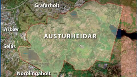
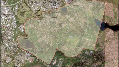
The Austurheiðar outdoor area is a total of approximately 930 hectares, covering most of Austurheiðar: Hólmsheiði, Grafarheiði, and Reynisvatnsheiði. The area includes Rauðavatn, Reynisvatn, and Langavatn. The project is in line with the approved Municipal Plan of Reykjavík City and supports Reykjavík City's policy to promote public health and make accessible outdoor areas.
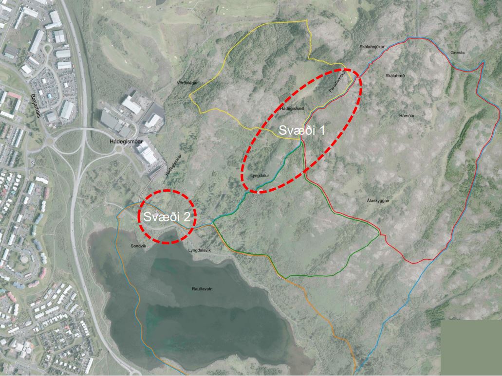
This phase will include work in two areas:
Lyngdalur and Skál
In the area called Lyngdalur, a play and rest area will be created, parking will be expanded, new gravel paths will be built and existing trails will be resurfaced.
Skál (Paradís/Paradísarskál) is popular with dog owners and allows dogs to run free in this area. Plans call for installing a dog training area and rest areas for people and animals. The trail to the area will be widened and other paths will be repaired. Benches and information signs will be installed, and walking paths will be marked.
Rauðavatn and walking path marking
A forest-style play and leisure area will be created near Rauðavatn with benches/tables, playground equipment and grilling facilities. An accessible trail will be built from the parking area to the new leisure area, with various trail connections extending from there. The area is designed to make Rauðavatn more accessible and allow visitors to experience the area's diverse wildlife and plant life, especially the bird life around the lake. During winter, these facilities will also serve skaters well.
Walking paths will be mapped and marked using a color-coded system. Information signs, trail markers and directional signs will also be installed.
Planning goals
The project is based on the approved framework plan for Austurheiðar, which was approved by the Planning and Transport Council on March 10, 2021. Austurheiðar is also part of the Green Belt, which refers to afforestation and outdoor areas on the outskirts of the seven municipalities in the capital area.
The objectives of creating a framework plan for Austurheiðar are diverse and aim to ensure the coordination of land use within the area to avoid conflicts of interest between current and future land use. The main goals are:
- Define and delineate areas based on their utilization.
- Create a diverse and accessible outdoor area for all age groups and different user groups, such as horseback riders, cross-country skiers, mountain bikers, off-road vehicles, walkers, runners, mushroom pickers, berry pickers, tourism services, and ultralight flying.
- Determine and define the location of main road connections and walking, cycling, and riding routes throughout the area.
- Strengthen the connection between built-up areas and outdoor areas.
- Strengthen the interaction and connection of Austurheiðar with adjacent outdoor areas.
Construction areas